Following on the heels of a driving intense trip last week around the Great Salt Lake, this week we were looking forward to a bit more physical of an adventure. This outing brings us down to the southern portion of the San Rafael Swell and into Capitol Reef National Park for a two day slot canyon trip.
We left Salt Lake City Saturday morning and had Alyssa’s sister Laura and her husband Chris joining us for the trip. We drove straight to Goblin Valley then west to the trailhead for Little Wild Horse Canyon. The weather was perfect, bluebird skies combined with high 60 degree temperatures which make for great hiking conditions. The plan was to hike the loop using Bell Canyon to go up then Little Wild Horse to come back down. Bell is the less extreme of the two and Chris made the smart suggestion of doing Bell first so we would have the best stuff, Little Wild Horse at the end. It was also a good plan since there a large number of cars parked at the trailhead and being that we were doing an afternoon start to the 7 mile hike, it would give time for the numbers to get off the trail and be less congestion.

The plan worked as the most people we saw all day were finishing the loop down Bell and by the time we got up into the open wash towards the top, fewer and fewer people were seen. From the top of the wash we hiked up and over a ridge following an atv trail that brings you into the top of Little Wild Horse.

I never tire of the contrast of the redrock and blue skies.

No shortage of cool rock formations sculpted by wind and water.

Alyssa, Laura, and Chris on the approach to the entrance to Little Wild Horse


As you travel further into Little Wildhorse from the north the canyon gets narrower and narrower and becomes an incredible slot canyon. There is a reason for this canyon’s popularity. It is easy to get to, it is non technical and mostly flat, and it is a classic slot. We were pretty stoked that we only came across a small handful of people on the entire trip back down.


We wrapped up the hike in around 4 hours from start to finish. Despite mild temps the effects of the sun and dry climate really dehydrate you easily. Even with drinking what I felt was alot of fluids I was feeling some effects from dehydration.
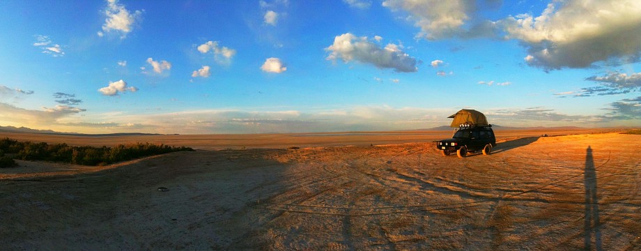
Our next mission was to find a place to camp for the night, make dinner, and sleep. Once you leave the Goblin Valley State Park heading west towards the trailhead you enter BLM land where you can stake your camping claim anyhwere that has a suitable place, ie not blazing off trail and creating a new route. Being the weekend and with the relative popularity of that area, we didn’t have high hopes for finding a good camping spot after coming off the trail so late. To our wonderment though the first spot we check out after leaving the trailhead was perfect. We wasted no time getting camp setup so we could get some food in us. In classic southern Utah spring tradition, there was a pretty strong, gusty wind blowing that was blowing sand and dust everywhere. This prompted us to deploy the changing room off of the roof top tent since it provides a place to make food with less sand in it. Always a plus.


Our cool camp site. We retired to the tent early, looked through photos from the day, listened to some reggae which always seems to fit the mood after a nice strenous outdoor activity in a serene place. The wind finally died down after midnight which made for peaceful sleeping for all.
After relaxed breakfast and packup session Sunday morning, we rolled out. There is a dirt route you can drive that works south towards Capitol Reef but we needed to top off fuel in Hanksville so we got back on pavement and entered the park in a more traditional way. It was to be another gorgeous day, perfect for hiking. After a quick visit to the park’s visitor center to get some beta on the route we headed down to the trail head. The original idea was to hike Burrow Wash which is a technical route on the eastern side of the park. After a talk with one of the rangers he suggested Cottonwood Wash. Typically Cottonwood has numerous water obstacles requiring swimming and wading but this year it was almost entirely dry, a very unusual thing. This sounded like a good opportunity to explore the canyon without having to get wet.
Getting to the trail head is an easy drive down the Norton-Bullfrog Rd on the east side of the park. After around 9 miles there is a pull off and a two track that winds a couple of miles up the dry wash to get you closer to the more interesting stuff. There are some loose rocks and deep sand but it was well within the clearance and capabilities of the Outback and Laura and Chris’s RAV 4.

After parking we wasted no time working our way up the trail. It isn’t till a mile or so up the wash that it starts getting interesting. By interesting I mean narrow and technical. While this route wasn’t wet, it still had some challenges to work through and get over.

Bridging the gap on one of the first obstacles.

The sandstone walls start to get narrow and taller in a hurry.

This giant chockstone and debry pile is easily 25 feet high and a first glance looks impassible without climbing gear. If you crawl up under it though there is a very narrow hole you can squeeze through to pop up behind it.

Getting narrow. Some of the tight spots required some creative moves and bracing to make it through and out of.

Alyssa working through a tight squeeze.

It was just wide enough to get through and climb out of.

While not a particularly long trail, the technical challenges make the progress slow, which is fine because it is also nice to stop and take it all in at times anyway.

The end of the route is after a 15 foot scramble that brings you into a sandy flat that opens up with a 30 foot waterfall (dry) that is impassable. At this point you have to double back.


A good example of the technique to get through some of the narrows.


The ranger mentioned it took him 6 hours to complete this route last week with 6 people and we felt pretty good to get through in around 4. It was an amazing trail and like the ranger’s description it was “strenuous” but it was unbelievably fun. We got back to the cars and stopped for a bite in Torrey before the haul back to Salt Lake.
This ended up being the most enjoyable outing yet this spring. Good people, good weather, and some of the most fun hiking I have yet done. We came out with some scrapes, some blood shed but also with some great memories. Thats what it is all about.
